
Orderly But Dumb: The Saga Continues
MEMBER NEWS DIGEST - THE LATEST AND GREATEST FROM OUR MEMBERS' BLOGS
Happy Jane Jacobs Day! (And now Urban Renewal Remembrance Day as well.) Today would have been the activist and urban theorist's 99th birthday, and it seems like every year, evidence continues to amass of her wisdom, foresight, and appeal to all corners of the political spectrum. One of the lessons many draw from Jane Jacobs's work is a healthy skepticism of "orderly but dumb" (as we put it here at Strong Towns ) public policy: the one-size-fits-all solution; the large-scale "renewal" or redevelopment project; or any policy that doesn't take into account the experiences and needs of the actual people who turn a collection of buildings and pavement into a place worth caring about.
Thanks most likely to CNU 23 in Dallas, this was a quieter week than usual on many of our members' blogs. But a number of them still posted some great content that we're happy to share with you all.
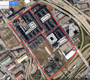
Proposed Camden Farmer's Market Apartments in Downtown Dallas
Patrick Kennedy of Walkable Dallas-Fort Worth takes readers to school yet again, this time on the importance of small block sizes in an urban grid:
Short and compact blocks do a better job at disbursing traffic throughout a grid because there are more opportunities to take alternate routes. The need for compact blocks is even more important for pedestrian use. In the words of the oft-quoted Jane Jacobs, “…opportunities to turn corners must be frequent.” Why? Think about your own experiences walking in cities. The streets you enjoyed were probably small and manageable where the buildings hugged the road and there were many opportunities to cut over on other side streets. These types of streets are scaled to the pedestrian level and they’re interesting because the scenery changes often and quickly.
Ah, you say, but this is the age of the mega-project. The developers who can afford to build in a place like downtown Dallas (and negotiate the regulatory complexities) are only interested in large projects and would be dissuaded by the requirement to accommodate the grid. They can deal with it, says Kennedy, but Dallas shouldn't sell out the long-term public interest to make things convenient for developers in the short term:
It’s always easier to develop a large tract of land and do with it as you please rather than work around the existing grid. But is this in the city’s long-term interest? Projects come and go. If the city bends over for every big development that comes along and disrupts the grid, what are we left with when those projects aren’t so shiny and new anymore? The city is left with an unreliable street grid. The city’s focus should be the long-term and how the grid system will be impacted many years down the road.
Density! Packed like sardines! Social engineering!
Most people would probably agree, in the abstract, that restricting the extent or nature of development to serve a public purpose is a legitimate function of local government, but when and how to restrict is often the source of political tension and controversy. Johnny at Granola Shotgun takes on the loaded notion of "social engineering." Too often, the term is used to mean "any land use or transit policy I don't like." But, says Johnny,
All forms of land use regulation are explicitly “social engineering”. Full stop. Let’s acknowledge that reality as we move forward. The question is never whether we’ll be engaging in manipulating society through land use regulations, but how and why.
The typical pejorative reference to “social engineering” includes things like government built subsidized low income housing or rent control imposed on private property.
[But] how about a municipality that dictates all new construction must be single family detached homes with a minimum 2,800 square feet on a lot that’s at least a quarter acre? What exactly is the logic behind that kind of land use control? Well… a particular town might want to “socially engineer” a middle class demographic in and a lower class demographic out.
Voters in some areas value the rural agricultural quality of the landscape and don’t want to see the place paved over with new subdivisions, gas stations, and strip malls. Land use regulations are put in place…. to keep most of the land unavailable for development. These policies do in fact preserve the beauty of the open landscape, but they also restrict the supply of buildings and drive up the cost of property in the area. “Social engineering.”
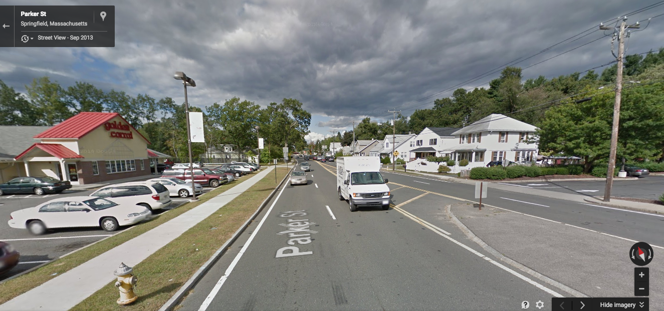
I thought about naming this Monday news digest "7 Reasons Jane Jacobs Was Right All Along (You Won't Believe Number 5!)". Yes, folks, we are living in the age of the listicle, and among the most ridiculous lists out there are often those that purport to rank cities by some set of criteria. Rational Urbanism's Steven Shultis deconstructs a recently-published list of the supposed "Safest Cities in America." It's not a hard task: for starters, the list was published by a manufacturer of home security systems. Nope, no possible ulterior motive there. Its implied message also makes a mockery of correlation vs. causation:
Nearly the entire list is made up of immensely wealthy bedroom communities…. In truth, you might as well publish a list of the wealthiest communities with the slogan “Live here, and you’ll be rich”! But we all know that living in Greenwich doesn’t make you rich, being rich allows you to live in Greenwich, and for most of us trying to live in Greenwich would impoverish us if we even tried!
But there is another, more subtle point here, says Steven. And it lies in the conflation of "safety" with "safety from violent crime."
Again, unmentioned methodologically is the fact that automobile death and injury are far more likely to impact the average person and most of these bedroom communities require long commutes on high speed roadways. As a matter of fact, the one suburban community from the Springfield area which made the list has a higher per capita death rate in terms of traffic fatalities than Springfield in spite of the fact that no interstate highway runs through it and Springfield has an interstate and a connector carrying millions of passengers a month.
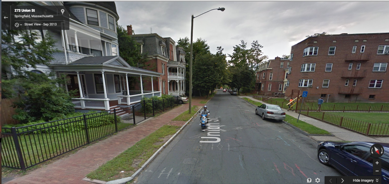
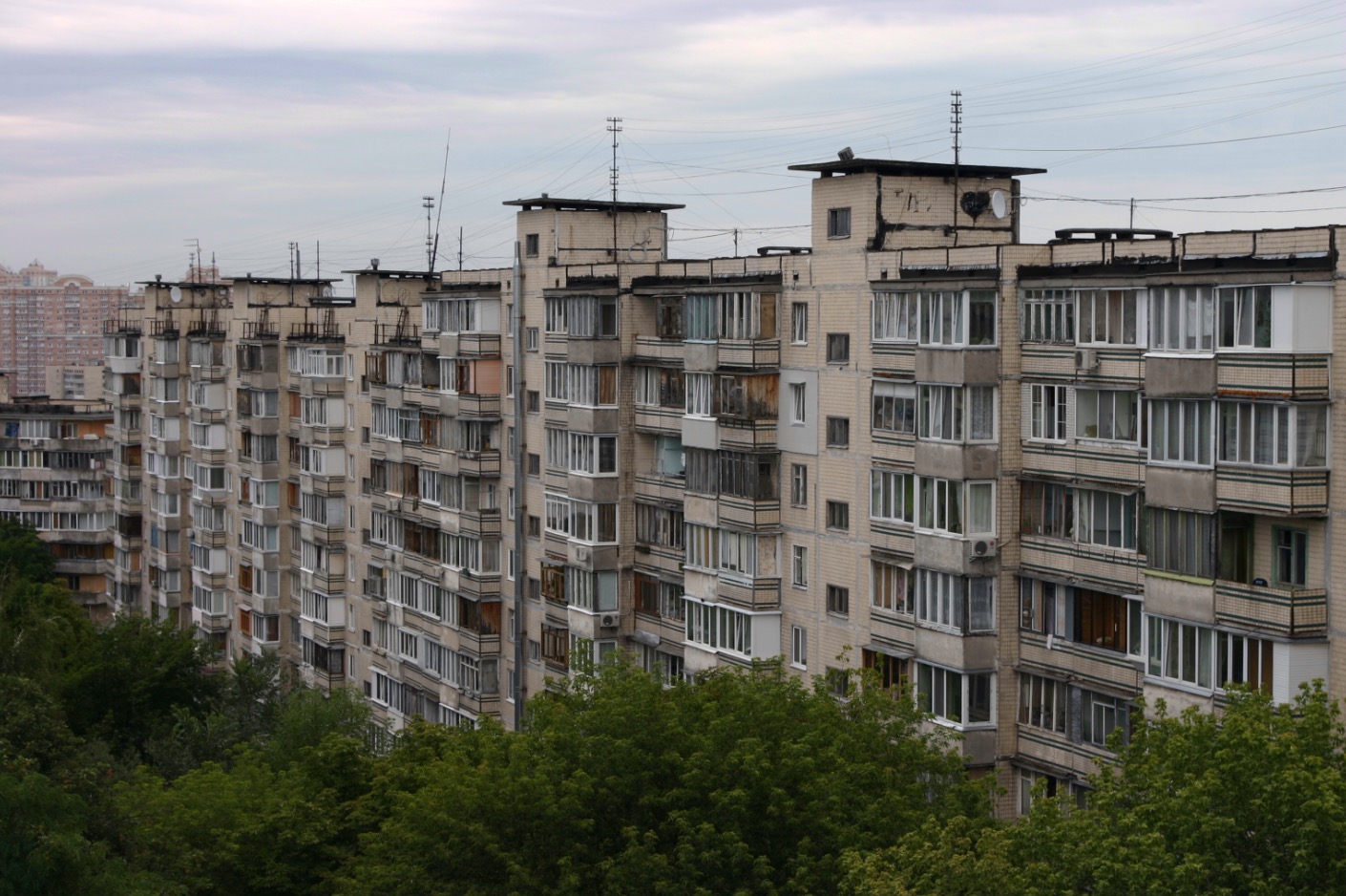
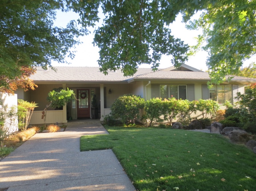
Which of the above places looks safer to be a kid? (Source: Google Street View)
This issue is not a technicality; this is a vastly important and widely misunderstood fact about public safety. It drives policy; it affects where parents choose to live and raise their children; it may have a lot to do with the controversies over free-range parenting that have received national press in recent months.
In the vast majority of places, motor vehicle accidents are a far more significant cause of premature death than violent crime is, and we would be well-served to point this out when misplaced fear about "safety" drives opposition to good urbanism and to policies that would make our cities into more productive and dynamic places.

Guess what! It doesn't look like this anymore!
MyParkingSign Blog describes Los Angeles's efforts toward sustainability. The city that created the blueprint for auto-oriented development has in some respects become an unlikely leader in efforts to turn that ship around:
Officials note the city’s population has grown by over 1 million in the past three decades, but L.A. uses the same amount of water. L.A. is investing in public transportation, and from 2005–2009, the metro area became more compact. Two-thirds of new housing was built on previously-developed land.
L.A.’s changes can serve to inspire “other not-so-green cities,” reports Slate. The city “started out as very strange, unlike the urban model found in Europe and the Northeast. And then it became more normal, as other places were similarly built around the automobile, subdivisions, and strip malls.” L.A. is becoming denser, more transit-centric, and less like the recognizable spread-out suburb that defined it.

Source: Google Street View
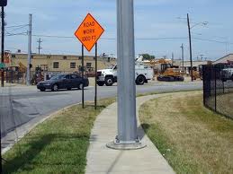
NextSTL offers the newest entry in its Do The Math series, training its sights on the planned demolition of a block whose oldest standing building dates to 1904. What's going up in its place? Surely there's a developer lined up who will—oh.
There is no plan for redevelopment in place. The old and blighted block is being razed in hopes that the shiny and new will come.
Hope springs eternal. Didn't we try this with mid-century urban "renewal"? The real problem here, Richard Bose explains, is that the auto-oriented stroad dramatically undermines the value of the block's historic buildings and prevents revitalization.

Surrounding context for the planned demolition
Lemey Ferry is a state-subsidized stroad. The traditional building pattern on the block is incompatible with the goals of a road- providing a high level of service (high volumes at high speed) to autos. The corner building offers bad sight lines at Bayless. There is no on-street parking; people park on the sidewalk. Access for anyone not in a car is unpleasant as well. The old buildings have little chance of succeeding in this environment- they are meant for a street. Lemay Ferry is a part of the secondary system of road maintenance in the Missouri 325 Plan. Perhaps St. Louis County should take over this part of the road and focus on making a street to add value to the buildings it serves.
The lowest bid for the demo was $108,000. What could be done to the buildings and surroundings for that amount to make the existing buildings attractive for rehab and reuse? Similar buildings in Maplewood are 2-3 time higher in assessed value per acre. That performance requires creating a place people want to be rather than one to drive through. Add sidewalks with curbs, trees, street parking? Demo one house for parking? Replace the houses with new ones? Do one of the most challenging improvements needed at the buildings like a sewer redo or new roof? Offer a facade makeover to a committed tenant? Replace one of the smallest buildings or a parking lots across Lemay with something more productive as catalyst for the others?
In other words we should think of cultivation rather than demo and hope.
North Bay Design Kit's Dave Alden examines the aggravating insult that is a meandering, illogical pedestrian path.
Twice in the last few weeks, I’ve seen alignments for non-vehicular routes that wandered back and forth like drunken sailors. One was the proposed alignment of a sidewalk. The other was the constructed alignment of a bike path. Both times, I gritted my teeth.
Curved paths for non-vehicular paths send terrible messages. Have you ever been heading somewhere on foot in a hurry, only to have to follow some capricious wandering alignment that was designed by someone who was never going to use the path? How did it make you feel? I’ve had the experience and it made me feel trivialized. It sent me the message that my needs as a pedestrian were frivolous. That my travel was less important that the travel of motorists heading to the same destination. That my need for timely arrival was secondary to someone else’s subjective judgment of beauty.
Anyone who walks or bikes has no doubt shared this experience of facilities that were clearly designed with little thought given to the experience of their actual users. Reminds me of this photo shared by frequent Strong Towns contributor Andrew Price last week:
There is zero chance the person who made this call actually walks as a means of transportation.
Perhaps one sensible policy reform to push for in our cities is to have all new public bike paths vetted by actual cyclists, bus stops scrutinized by actual transit riders, and so forth. It's just so clear sometimes that nothing of the sort has happened.

Bill Emory's photo blog gives us the above photo of a railroad crossing that had been used by pedestrians for literally over a century, closed without any warning or public consultation. I imagine the most likely reason for the closure was "safety"—and what if it now drives people into their cars to make trips they formerly would have made on foot?
Orderly but dumb.
You can check out the entire member blogroll on the Strong Towns member site. If you're a member with a blog and would like your work to show up there, please let us know about it.