
Can Alexandria Breathe New Life into a Dead Mall?
The following article is re-published with permission from the Greater Greater Washington blog.
In the West End of Alexandria, there are plans to replace a defunct shopping mall with a neighborhood where people can live and do some of their day-to-day errands without having to get into a car. The redevelopment promises to provide new opportunities for the area, but new buildings alone cannot ensure a successful place to live and work.
Built in 1965, Landmark Mall sits nested between I-395, Duke Street, Van Dorn Street, and a maze of ramps that even confuse locals. The mall has been struggling for some time now-- it'd be safe to call Landmark a dead mall, a term for enclosed shopping malls that people no longer use for retail shopping-- and plans for redevelopment have been on the books since at least 2006.

Landmark Mall, with I-395 to the north, Duke Street to the south, and Van Dorn Street to the east. Image by Google Maps.
Now, redevelopment may move forward, with the Howard Hughes Corporation planning a grid of streets to replace the former mall structure and its parking lots. Hughes envisions a mix of residential and commercial spaces would fill in the new blocks creating a walkable grid for the new neighborhood. Remaining store owners at the mall have been asked to vacate the premises and Macy's is closing down its location here.

Rendering of new Landmark site with new green space and mixed use buildings. Image by City of Alexandria.
The West End's landscape is changing
While some of Alexandria's neighborhoods like Old Town and Del Ray are famous for their walkability, development in the western half of the city focused on a 20th century model that prioritized moving cars over anything else. That's definitely the case at Landmark. Currently surrounded by various on-ramps, the mall was built with the expectation that few would ever visit the mall except by car.
The redevelopment promises a neighborhood where people are encouraged to walk between homes and shops. That would make Landmark the latest in a series of other nearby projects aimed at making the West End walkable.
Cameron Station is a large development nearby, also between Duke and Van Dorn Streets, that was designed with a focus on walkability and other traditional urban principles. Plans to make the Bureaugard Street corridor more walkable and transit friendly just on the other side of I-395 are underway as well. And other smaller projects have been built near and around the Van Dorn Station on Metro's Blue Line.
Redevelopment at Landmark would be a big step towards making all of Alexandria walkable rather than a few select neighborhoods.
Transit Oriented Development near Van Dorn Street. You can find some of this already in western Alexandria. Image from Google Maps.
New buildings won't solve everything
But even if the Landmark redevelopment goes as planned, some serious challenges will remain, which is only natural when the road network around the mall reflects the expectation that everyone would drive to do their shopping.
Ramps that encourage driving without stopping or slowing down crisscross the area, making it hard for anyone looking to walk or bike. The plans to redevelop the site won't touch any of these ramps, leaving the walkable area envisioned in the new space isolated and hemmed in by highways. Older plans call for eventually replacing the overpasses with a grid intersections, but there is no timeline for when this could occur and it will likely happen on a piece by piece basis.

Near the "intersection" of Duke and Van Dorn. Good luck crossing this. Image from Google Maps.
There is some bus service in the area, and the coming West End Transit Way, a BRT line with some dedicated lanes between the Pentagon and Van Dorn Street Stations. But current plans have the station around Landmark far away from where the heart of the new neighborhood is supposed to be.
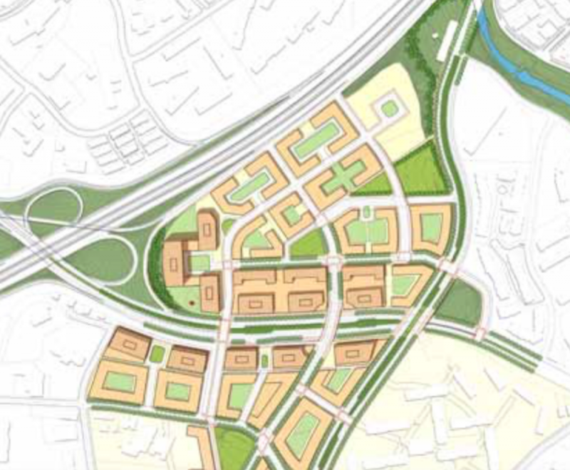
This plan from 2009 shows what a full street grid could look like. Image by City of Alexandria.
Cyclists face many of the same issues pedestrians do in the area, though bike lanes have been painted on portions of Van Dorn Street north of the mall. Also, the Holmes Run Trail is a nearby option for biking, but it floods occasionally. Work to fix that is underway, and that would make the trail more useable throughout the year.
Another challenge is how remaining land around the department stores will affect current and future plans. Sears is going to stick around and there's no indication of what the future plan for the store is. That means some of the site will still be devoted to a big box store with its own sections of parking. It may be years before those parcels see a new use.
Macy's also has a store on site, but it was slated to close earlier this month. In response, the Howard Hughes Corporation bought the building and the land it's on. But it is too early to say what changes to the current plan will be.
Redeveloping sites like this is a great way to make areas of the region more walkable and transit-friendly, but new buildings alone cannot do it, especially when those new buildings are cut off from the larger community. Plans to fix this may be on the books, but redevelopment alone can only do so much for Landmark and the West End.
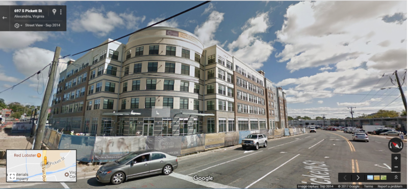
(Top photo of Landmark in 2011. The mall was so empty it's parking lots could be used for Carnivals. Image by Anokarina licensed under Creative Commons)
Related stories


You can learn a lot about a place by how easily you can do some great Christmas shopping.