
The Trouble With Bike Infrastructure In Snowy Cities
Arian Horbovetz (Twitter: @Arianhorbovetz) is a Strong Towns member who blogs at The Urban Phoenix. This post is republished from his blog with permission. You can also check out the Urban Phoenix Podcast for more of Arian’s great work.
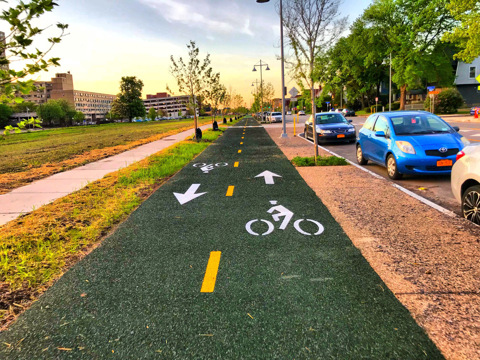
The Union Street Cycle Track in Rochester is a fantastic resource for urban cyclists, but during five months of winter, it’s covered with snow. Image by the author.
Currently, my city of Rochester, New York is the countrywide leader in snow fall this winter. This is nothing new. For five cold months out of the year, Rochester and Upstate New York communities receive an average of 80-100 inches of snow. Even for the most hearty cyclists like myself, this creates a real problem.
And while the rest of the country’s cycling community demands that protected bike lanes be the answer for safe bike riding all year long, my midsized urban home, along with others like us, are faced with a cruel reality: our cities will likely never devote funding to plow and maintain sidewalks and bike infrastructure like they do roads.
Take our most prized piece of downtown cycling highway, the Union Street Cycle Track. For months at a time, this mile-long downtown connector is buried under snow. It is, for all practical cycling purposes, useless for a quarter of the year. Yet for much of that time, the street adjacent to it is extremely well plowed. And thankfully, that street has a low traffic volume. It’s relatively easy to make the switch to biking along Union Street during the snowy months.
The Genesee Riverway Trail, which hugs the banks of the historic Genesee River as it cuts north and south of Rochester, is a beautiful and practical two-wheel commuter route, connecting downtown with The University of Rochester and the University of Rochester Medical Center.

The Genesee Riverway Trail. Image by the author.
But once again, this valuable artery for active transportation is essentially negated during the winter months. On the south side of the city, the busy Mount Hope Avenue is the closest alternative route along this corridor. While a portion of this route has shoulders and even bike lanes, most of it plays host to a traffic count of over 20,000 cars per day. Furthermore, while the Genesee Riverway Trail is flat, nearby Mount Hope Ave. traverses a steep climb as it passes Mount Hope Cemetery where Susan B. Anthony and Frederick Douglass lie in eternal rest.
Finally, the Empire State Trail just south of Rochester makes its way along the Erie Canal. In fact, Rochester is nearly centered on a stretch of this trail, which is uninterrupted for 100 miles from Lockport, New York near Buffalo, to Lyons, New York in between Rochester and Syracuse. But during the winter, the snow that collects on this trail quickly turns to ice, likely due to its close proximity to the canal.

The Empire State Trail, covered in snow and ice on a February day. This cycling connector between suburbs and Rochester (including multiple major employers) is virtually impassable for bikes during most of the winter. The alternative routes are, for the most part, heavy traffic roads built for automobile speed. Image by the author.
Because of this, it is difficult to traverse on bike, and this icy trail is often the last to melt when the temperatures warm. The most ideal way for cycling commuters and recreational cyclists to travel from Rochester to the beautiful towns along the Erie Canal, or vice versa, is simply not an option for most of the winter. Instead, we must rely on East/West roadways, which, while usually well plowed, are usually high-volume, multi-lane car traffic corridors.
And protected bike lanes? We really don’t have those here. And if we did, they’d likely never be plowed.
The reality of strong cycling infrastructure in small-to-midsized snowy cities like ours is this: they will likely never be plowed, making them useless for nearly a quarter of the year. Cities and municipalities will always have the resources to plow, treat, and salt roads. But a five-foot bike lane, or a trail that might encourage winter activity and car-free commuting? Realistically that will never be in the budget for most of us. So we must take to the roads, and, quite often, those roads are no place for cyclists, especially when the temperatures drop below freezing. During the warmer months, I commute by bike on trail for about three miles, followed by one mile on a 20,000 car-par-day, six-lane road, which laughably has bike lanes. Still, it’s better than nothing.
But during the winter, I must take speed-inducing roads with 20,000 cars-per-day virtually the whole way, as the trails I typically ride during the spring, summer, and fall are covered in snow and ice. The roads I must travel, of course, are perfectly plowed so that cars may adequately speed past me at unsafe distances.
Snowy cities like Rochester must continue to expand cycling infrastructure, but safer street design and slowing the cars is even more important if we are going to give cyclists, pedestrians and public transportation users a fighting chance during the winter months. Since most of our dedicated, car-free options are virtually eliminated for four to five months out of the year, it is vital that the streets that parallel these arteries for alternative transportation offer a place for cyclists and others during the winter months. These aren’t protected bike lanes that will never be plowed, they are bike routes that allow for safe, convenient and comfortable multi-modal travel all year round.
Top image via Arian Horbovetz.


Who would go cycling in snowy conditions, in a city with a 764-foot-high hill right in the middle of it? Montrealers, and the city’s bikeshare program has the stats to prove it.