Modern Urban Planning Is Inside Out

When is a public park not a public park?
Perhaps when it’s tucked away somewhere the public will never find it—and when this is almost certainly by design.
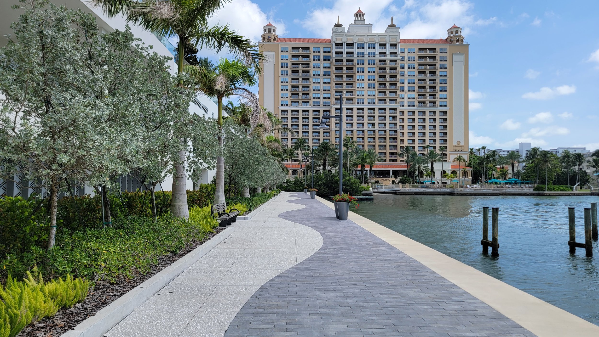
On a walk last week, I checked out the site of my city of Sarasota’s largest ongoing development project. In multiple phases, a huge tract of vacant waterfront land downtown is being turned into The Quay, a 14-acre complex of several high-end condo towers, retail, restaurants, and office space. (It replaces a former nightlife and dining complex of the same name, demolished in 2007.)
This billion-dollar project is happening at one of the most prominent locations in the whole city: the spot where the main road into town from the freeway ends at the shore of Sarasota Bay. So millions of people a year will see this location on their way to our downtown or the beach.
The city required the new owner, as part of the development agreement, to create a park. This makes perfect sense. Such a prominent site right on the water should long ago have been reserved for the public. But since it’s in private hands, and too expensive for the city to buy it back, the next-best option is to use the development approval process to require some public space as part of what will be a staggeringly lucrative private development project.
The problem is that the park they made is completely invisible from outside the new development. When you approach the site, Fruitville Road (that primary east-west thoroughfare I described earlier) dead-ends at…this view:
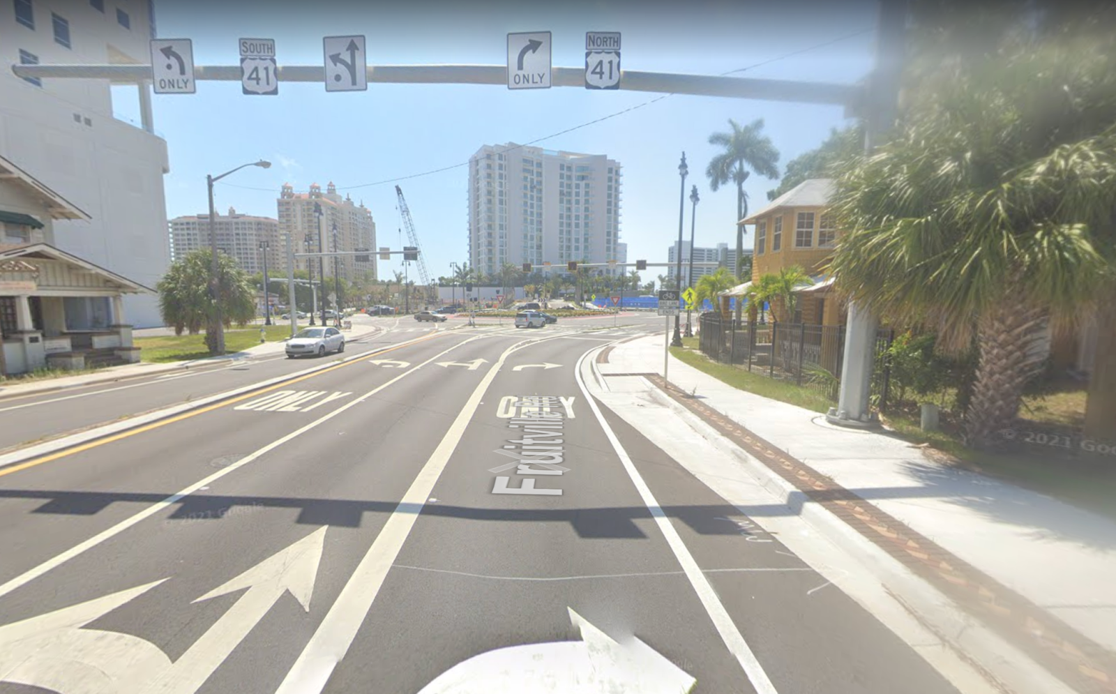
The bay is hidden behind a large condo tower that, oddly, does not directly face the street but is at a slightly skewed angle to it. The park, while open to the public, is kind of tucked off to the right of that building. You would have no idea it’s there, unless you already know it’s there. The best small urban parks are places you can stumble upon or pass through on a walk to somewhere else, but this is, by design, not on the way to anything.

Once you reach it, you’re in what is basically a modest lawn for the adjoining condo towers. A prominent “Private Property” sign greets you, though the space is open to the public. I’m guessing those residents would rather not actually mingle with the hoi polloi, and that the developer knows this. On the left, you have a blank wall; on the right, a chain-link fence.


Want to take a nice stroll along the water? Well, you’re out of luck, because you very quickly hit a dead end in either direction. A sky bridge connects the Ritz Carlton Residences (part of the Quay) to the adjacent, older Ritz Carlton hotel, but at the ground level, there is no passage between these properties.

We actually have an official Bayfront Trail for people walking and biking. “Bayfront” is doing a lot of work in the name, though. Since most of the actual bayfront is walled-off private property, the path takes this absurd route through the area:

The miserable sidewalk in front of the red-roofed building in this photo is part of that path:

This speaks to a bigger problem. Sarasota is a coastal city whose primary economic driver is tourism. Yet public access to the water is scarce, particularly on Sarasota Bay, which the urban core fronts. (The Gulf of Mexico is separated from our downtown and core neighborhoods by the bay and a set of barrier islands.) Early leaders made a huge, historic planning mistake when they sold off most of the waterfront to private buyers.
(This decision was not just bad for public water access; it was bad for the community’s financial wealth. Data-driven research by Urban3 has found that preserving shoreline for public use delivers more of a boost to total property values than privatizing it, because the benefits of water proximity then transfer to everyone within a reasonable distance, instead of only being enjoyed by the owners of waterfront property.)
Over time, city leaders have come to recognize this historic mistake—somewhat. That’s why the park requirement was there in the Quay’s development agreement. Absent, however, was any insistence that the site be developed in a way that actually: (a) creates a compelling and active public space, or (b) creates a significant landmark for the public befitting such an important, central intersection.
This is a huge missed opportunity, and one that’s likely familiar to you if you live pretty much anywhere in America developed (or redeveloped) in the last 70 years. Sadly, the norm across this country is that public space is disconnected, fragmented, incoherent. The city is reduced to a collection of individual tracts of private property that exist alongside each other, but in little meaningful relationship to each other.
It wasn’t always like this. It shouldn’t be like this.
If the Revolution Came to Your Town, Would People Intuitively Know Where To Gather?
A few years back, we published a “Strong Towns Strength Test” meant to get readers thinking about the indicators of a place that’s making the right moves toward resilience and long-term prosperity. Item #2 on the test was, “If the revolution came to your town, would people intuitively know where to gather?”
What this question was getting at is whether your town has a vibrant and legible public realm. By vibrant I mean, “Do people habitually gather, meet, and spend time in public places?” By legible I mean, “Does the design of the community lead them to specific centrally or prominently located public places?” Is there some sort of town square or central plaza? Is there an obvious route along which people would walk before or after gathering there? Are there streets that people intuitively understand as destinations or central axes of the town?
This used to be a core concern of urban planning: not preparing for revolution per se, of course, but certainly creating public spaces with some grandeur and centrality that were intended to act as focal points for the community. This has been done throughout human history because a well-designed public realm is a magnifier for value-generating activity, and thus ultimately for the wealth that sustains a community over generations. It draws people in, and it sends a powerful signal to private property owners: “This place is permanent. Invest here.”


Nearly every town of any consequence in Latin America has a public square (most often called the Plaza de Armas) at its center, ringed by important or civic buildings. This is a direct consequence of the Law of the Indies, the urban planning rulebook used by the Spanish in their colonies. In British America, the main street of a town would often dead-end at a significant building like a church (a design technique called a terminating vista). Other times, natural features became the basis for a thoughtful arrangement of private land use. This can be seen on downtown Chicago’s waterfront, where Michigan Avenue provides a stately, prominent border between public parkland and private development.
None of this happened by accident. It was the work of planners who understood that in laying out cities around high-quality public space, they were creating a platform for the building of wealth that would last many generations, long after they themselves were gone.
Why Did We Turn Physical Planning Over to Private Interests?
I say this because compared to the kind of planning that I described above, contemporary urban planning has gotten turned inside out. Today, city planning departments obsess over what happens inside buildings but pay scant attention to the quality of the space outside them.
Whole books would be required to tell the story of why this is. But in short, urban planners in U.S. cities used to do a lot more of what’s called physical planning—the literal layout of the streets and public spaces in a city, and determining things like the location of parks and civic landmarks within a neighborhood. Governments involved themselves in this process to highly varying degrees. Often it was as simple as providing a regular grid of streets, while at the other end of the spectrum you’d see elaborate citywide layouts that shaped cities like Washington, DC; Savannah; and later Chicago. This kind of master planning was not very democratic, and certainly had its own problems, which are beyond the scope of this piece. The part I want to focus on is the proactive involvement in identifying prominent sites and reserving them for public purposes, and creating a cohesive urban fabric.

The L’Enfant Plan of Washington, 1792. (Source: Flickr.)
Today, government almost never does anything like this. Planning departments are mostly zoning departments, micromanaging the use and intensity (far less often the physical form) of private development, but making very few design decisions of any consequence. When a private developer builds anything larger than a single block, whether something like the Quay, or a new master-planned suburb, the developer does their own subdivision plan, deciding where the streets, sidewalks, parks, and everything else will go. Cities regulate this process (indeed, subdivision regulations are tremendously important and underappreciated), but they don’t direct it.
As a result, new private developments tend not to connect well with or flow well into each other, and they tend to be insular enclaves. The Quay, although it’s a high-rise complex on a downtown site, is following a fundamentally suburban logic, the same as a new subdivision: it’s a pod unto itself. You won’t easily be able to walk in or out from adjoining developments. And the park is buried on the inside, invisible to those passing by.
The largest culprit for this shift is not the rise of zoning, but the dominance of the automobile. When you walk (or move at closer to walking speed) you experience public space with all of your senses as a continuous place. The streets and plazas you pass along and through aren’t your final destination, but they’re somewhere you’re aware of being, and you take notice of their qualities. But people who drive don’t experience this same continuity. When you drive from one individual private space (say, your home) to another (say, the gym, or your office, or a restaurant), the journey in between them is sped up and lacks all that sensory richness and time to observe. In this sense, driving is probably more similar to teleporting from point A to point B than it is to walking there.
We’ve institutionalized this windshield mentality through planning that doesn’t concern itself with public spaces as places, only as transportation corridors. As a result, we build increasingly incoherent cities. Prominent streets dead-end at nothing of interest: a blank wall, a gas station, an empty field. Buildings don’t even front the street in any sort of consistent or coherent way; they often just seem arbitrarily arranged on their lots. (In reality, they’re usually arranged around the demands of parking more than any other factor.)
It’s time to reclaim physical planning as part of the job. Not in the sense of a master planner like Washington’s Pierre L’Enfant—cities aren’t blank slates on that scale anymore, anyway. But with the recognition that the public sector is the entity that actually has the incentives and mandate to maximize the place-defining power of the public realm. That is, to make sure there’s some there there.
Daniel Herriges has been a regular contributor to Strong Towns since 2015 and is a founding member of the Strong Towns movement. He is the co-author of Escaping the Housing Trap: The Strong Towns Response to the Housing Crisis, with Charles Marohn. Daniel now works as the Policy Director at the Parking Reform Network, an organization which seeks to accelerate the reform of harmful parking policies by educating the public about these policies and serving as a connecting hub for advocates and policy makers. Daniel’s work reflects a lifelong fascination with cities and how they work. When he’s not perusing maps (for work or pleasure), he can be found exploring out-of-the-way neighborhoods on foot or bicycle. Daniel has lived in Northern California and Southwest Florida, and he now resides back in his hometown of St. Paul, Minnesota, along with his wife and two children. Daniel has a Masters in Urban and Regional Planning from the University of Minnesota.