Life Imitates Hollywood: The Rise of "Movie Set Urbanism"
You know those rows of fake building facades with nothing behind them that you see on a movie set, like for an old Western? They’re, of course, carefully shot from a limited range of angles during film production to disguise the fact that these places are all hat and no cattle.
Well, this trick is not just for Hollywood anymore.
Something funny has happened since the rise of New Urbanism as an architecture and design movement in the 1980s and 1990s. The New Urbanists’ resurrection of traditional pre-WWII American built forms—the walkable neighborhood main street with shops along the sidewalk and apartments above; the narrow, shady residential streets; the foursquare home with a quaint front porch—proved popular with the public. People gravitate to traditional design, not only for nostalgic reasons but because it follows principles evolved to meet humans’ basic psychological needs.
What hasn’t proven so popular among developers is actually challenging the basic spatial logic of suburbia, in which different land uses are strictly separated and everyone drives everywhere, on wide stroads that connect one pod-like “development” to another. This logic is wired into our zoning codes through things like parking minimums and subdivision regulations.
And so, the look and superficial feel of New Urbanism is increasingly just co-opted by developers of run-of-the-mill suburbia to make consumers feel like they’re being sold something other than run-of-the-mill suburbia. Call it Movie Set Urbanism.
Take, for example, the marketing around a new master-planned “town center” district in Florida (currently under construction). At first, the artists’ renderings of this place look pretty promising:
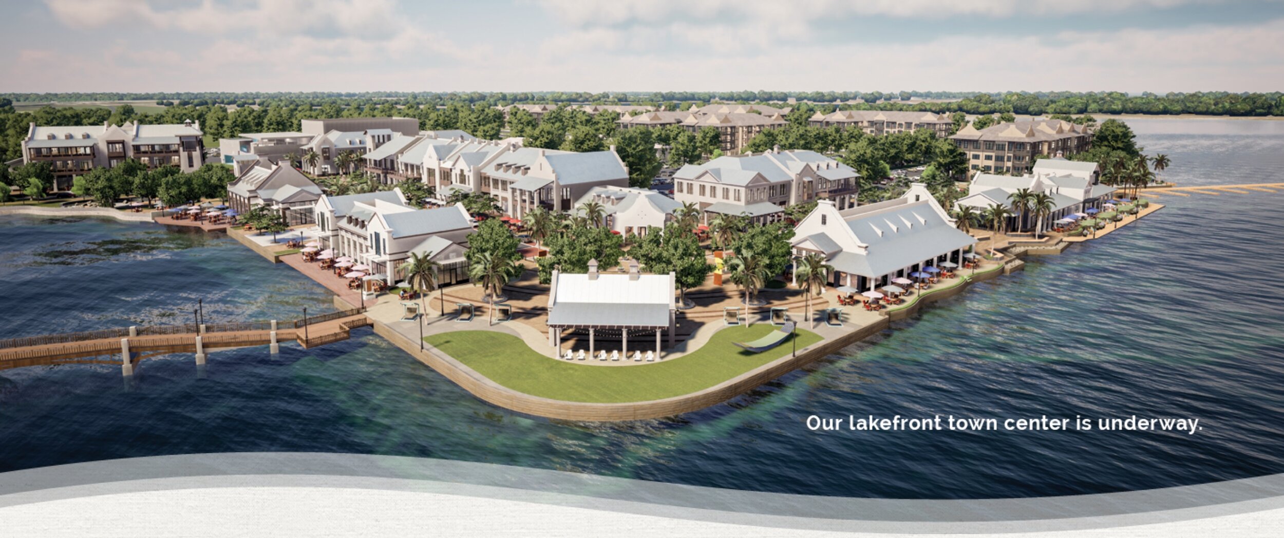
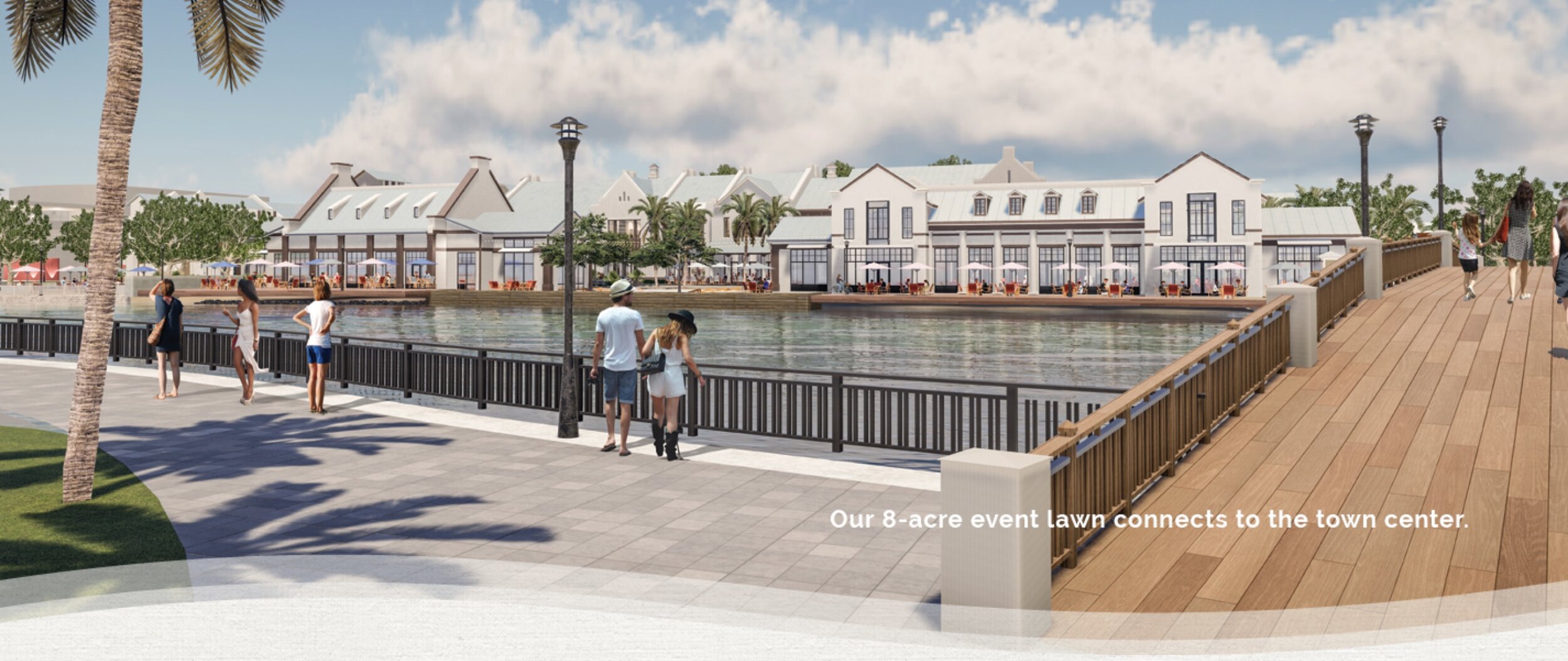
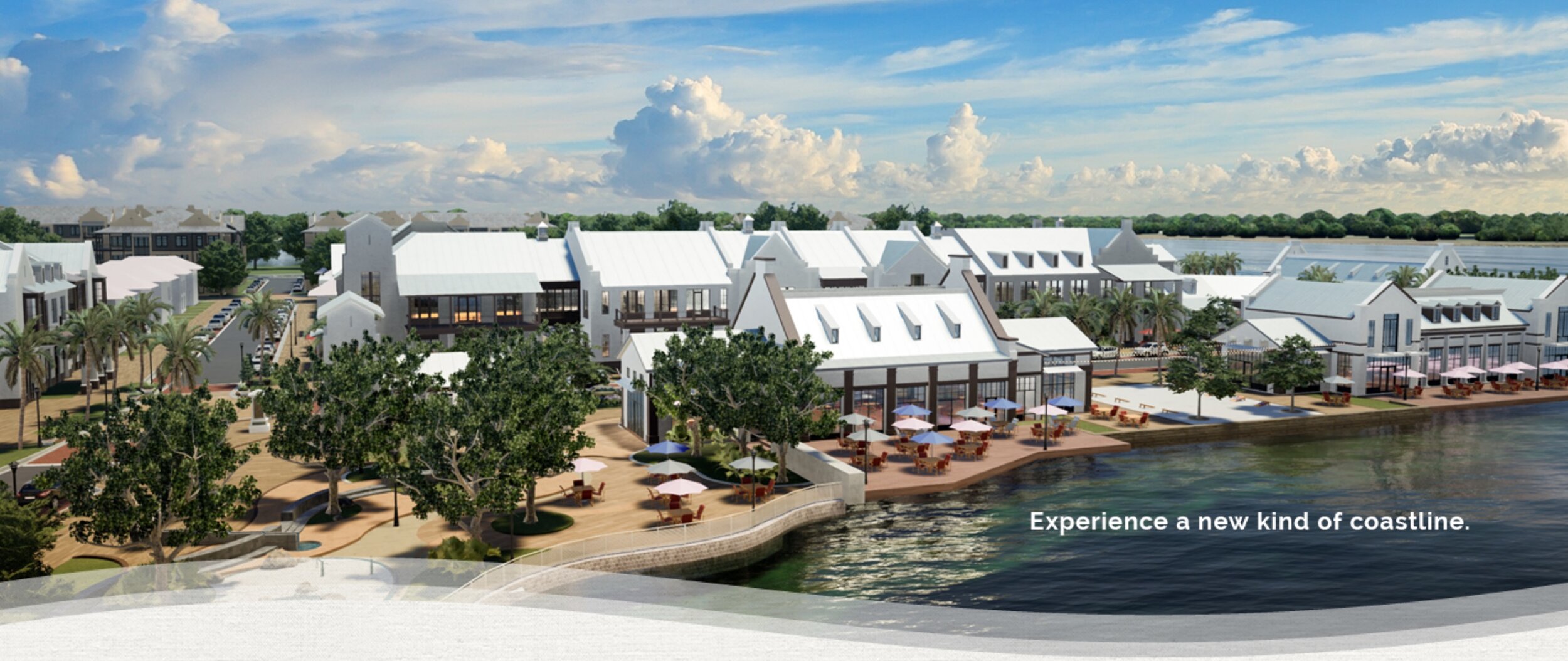
These could almost pass for artwork of an actual, historic waterfront town, compactly built to allow people to step out their front door and stroll to buy the day’s groceries, meet a neighbor for coffee, or work in an office building upstairs from a restaurant. But just like a movie set with a row of fake facades, the issue lies in what’s on the other side of those nice walkable streets. It starts with a “P” and ends with an “Arking.”
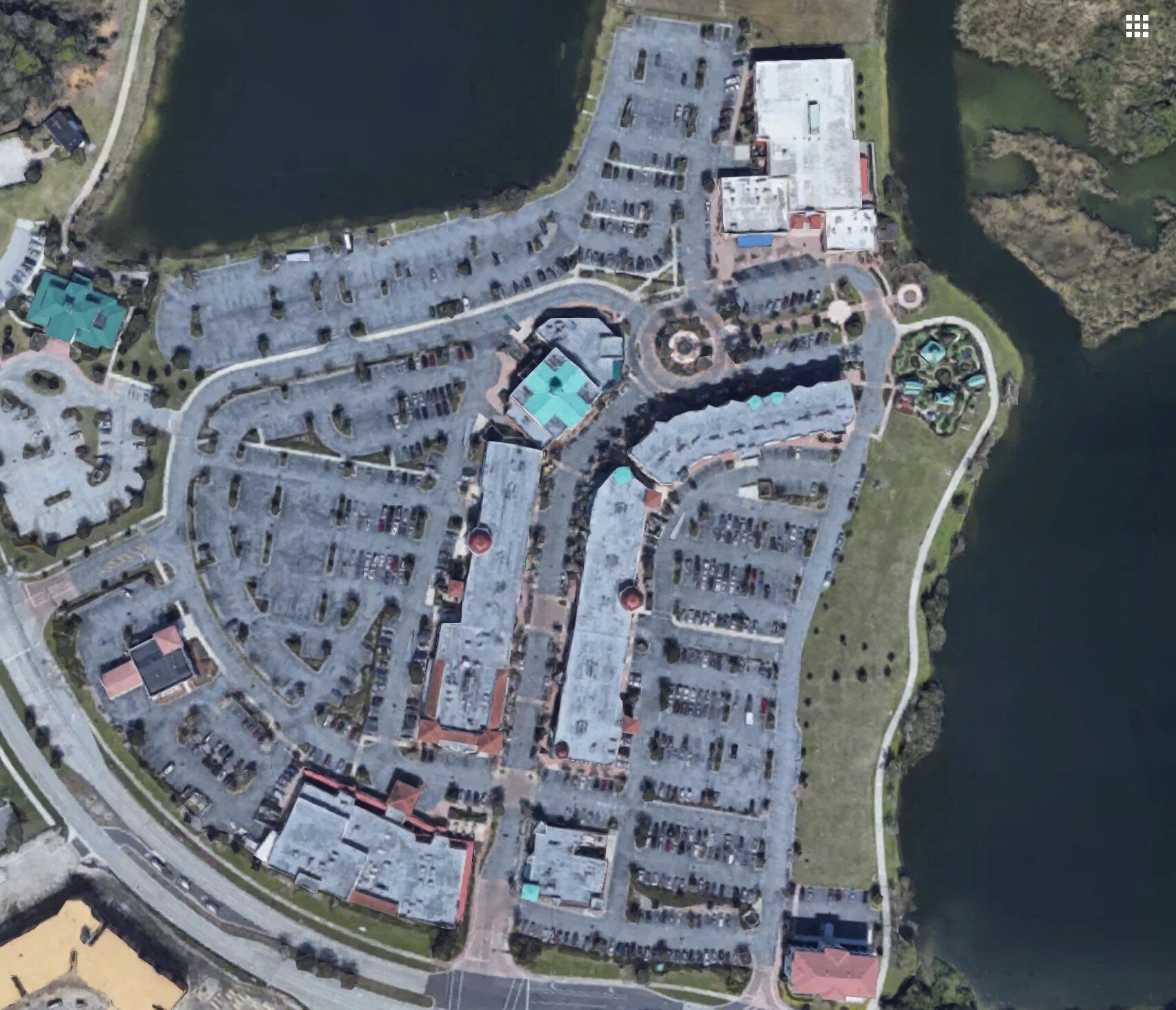
This is part of a larger master-planned development being phased in over more than a decade, with over 5,000 homes (and thus likely more than 10,000 inhabitants) at completion. Now, 10,000 people could be the makings of a sizable town, one with a self-sustaining job market and a healthy mix of local businesses that serve residents. But this isn’t going to be that, because there is no meaningful connectivity between the neighborhoods that will house most of those 10,000, and this manufactured “downtown,” which the map above clearly shows is its own isolated enclave.
This is intended as pure drive-to urbanism, a novelty to enjoy for the afternoon or evening, not a place to do all the stuff of life.
I’ve seen this movie before, because the same developer built another lovely “Main Street” a decade ago. It has buildings that come up to meet the sidewalk, providing a continuous street wall and feeling of enclosure. There are wide sidewalks with benches, streetlights. There’s a mix of cafés and shops with a few apartments on top. It passes the New Urbanism sniff test… until you rotate your view 90° to the right and realize what’s behind these buildings on the other side (in both directions):
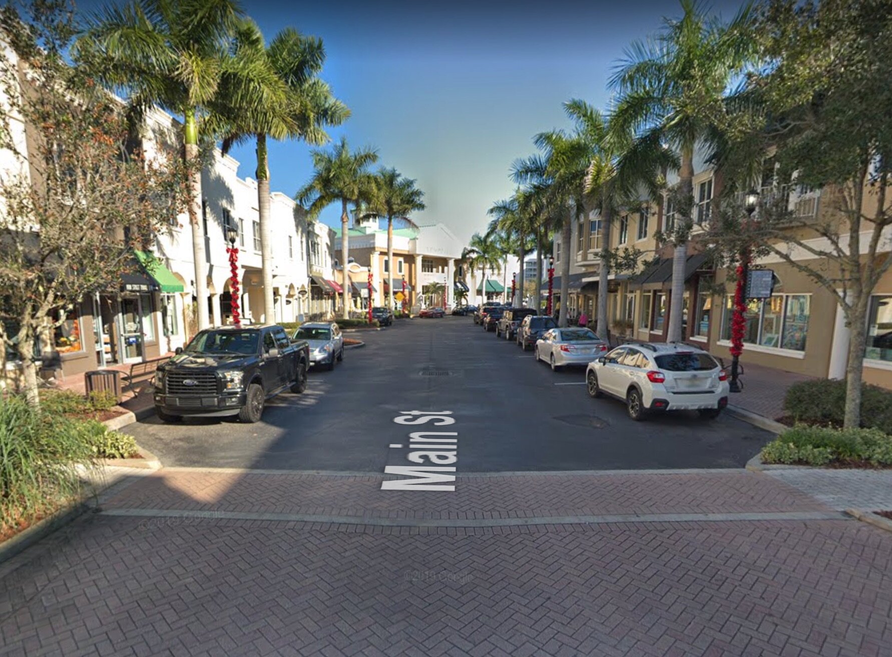
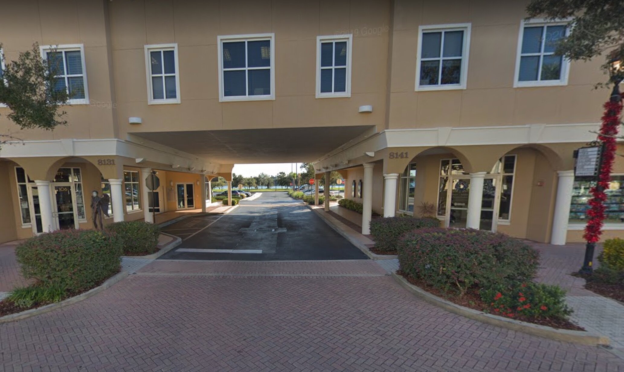
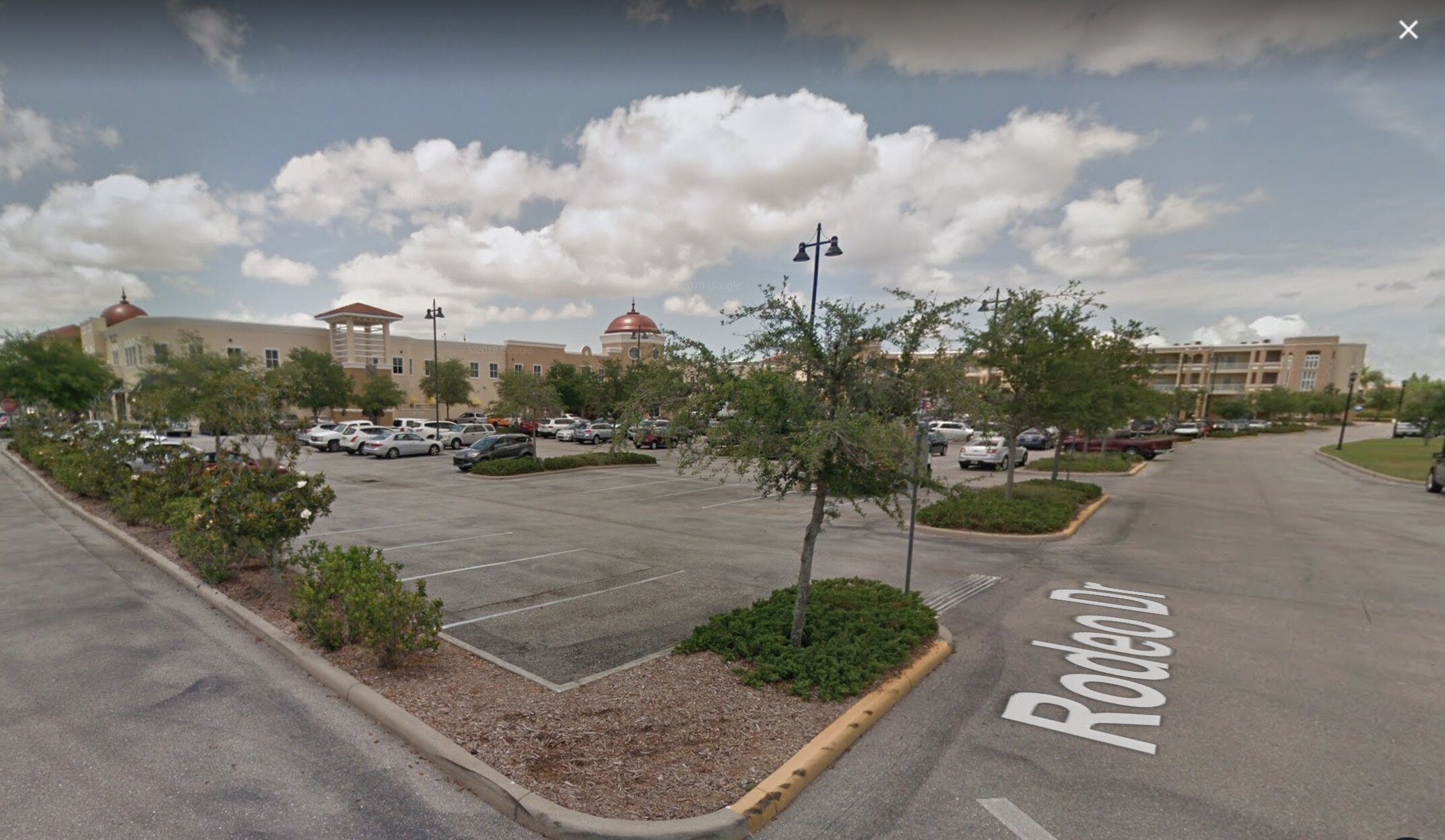
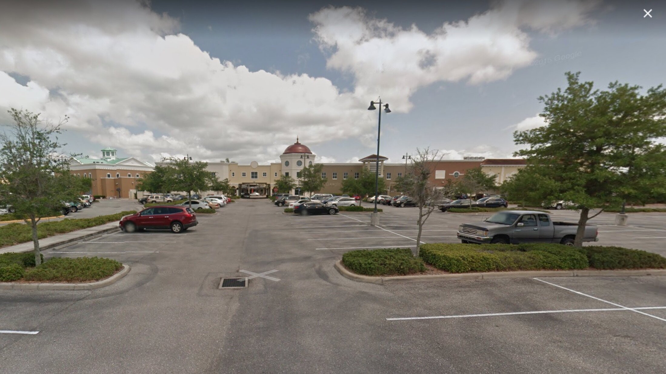
Parking madness!
We’ve been critical of such “town squares out of thin air” before for several reasons, including that the all-at-once, manufactured development approach doesn’t readily allow for versatility in how the buildings are arranged and how they’re used; there’s no gradual feedback process of discerning what works. As a result, these places tend not to hold their value over time, and to feel very dated after a couple decades.
You get something that is an entertainment product—it looks cute, but it’s functionally like a movie set or a theme park. Its design has the aesthetic signifiers of a traditional town, but none of the functionality, none of the deep responsiveness to the needs of the people living there.
And these places are also liabilities from a public-finance point of view because their drive-to, drive-away nature means that huge amounts of the land must go to roads and parking, which require maintenance but generate no direct value, and no tax revenue for the local government. A good way to understand the inefficiency is with a place-versus-non-place map:
I’ve color-coded the land uses and calculated how much space each takes up:
|
Color |
Use |
Percent |
|
Light Green |
Undeveloped Open Space |
38% |
|
Red |
Parking Lots |
18% |
|
Dark Green and Beige |
Parks and Plazas |
15% |
|
Gray |
Buildings |
9% |
|
Orange |
Streets |
9% |
|
(Uncategorized) |
Other (Mostly Landscaping) |
11% |
Excluding the open space (supposedly to be a nature preserve, but it’s unclear to me how accessible all of this land will be to the public for recreational use), only 39% of the developed land is "place"—that is, literally anywhere you'd want to be. 61% of it is “non-place”—the roads, parking lots, and landscaping buffers that are there to facilitate movement and access, but where no humans will linger.
And parking clocks in at a full 29% of the developed land here, taking up twice as much total space as the actual buildings.
Until you deal with the parking problem—which is done by building truly mixed-use places where people can meet their daily needs without hopping in the car—you haven’t created true urbanism. Just movie set urbanism.
(Cover photo by mlhradio via Flickr. Creative Commons license.)
Daniel Herriges has been a regular contributor to Strong Towns since 2015 and is a founding member of the Strong Towns movement. He is the co-author of Escaping the Housing Trap: The Strong Towns Response to the Housing Crisis, with Charles Marohn. Daniel now works as the Policy Director at the Parking Reform Network, an organization which seeks to accelerate the reform of harmful parking policies by educating the public about these policies and serving as a connecting hub for advocates and policy makers. Daniel’s work reflects a lifelong fascination with cities and how they work. When he’s not perusing maps (for work or pleasure), he can be found exploring out-of-the-way neighborhoods on foot or bicycle. Daniel has lived in Northern California and Southwest Florida, and he now resides back in his hometown of St. Paul, Minnesota, along with his wife and two children. Daniel has a Masters in Urban and Regional Planning from the University of Minnesota.