When a School Ends Up on an Arterial Road
.avif)
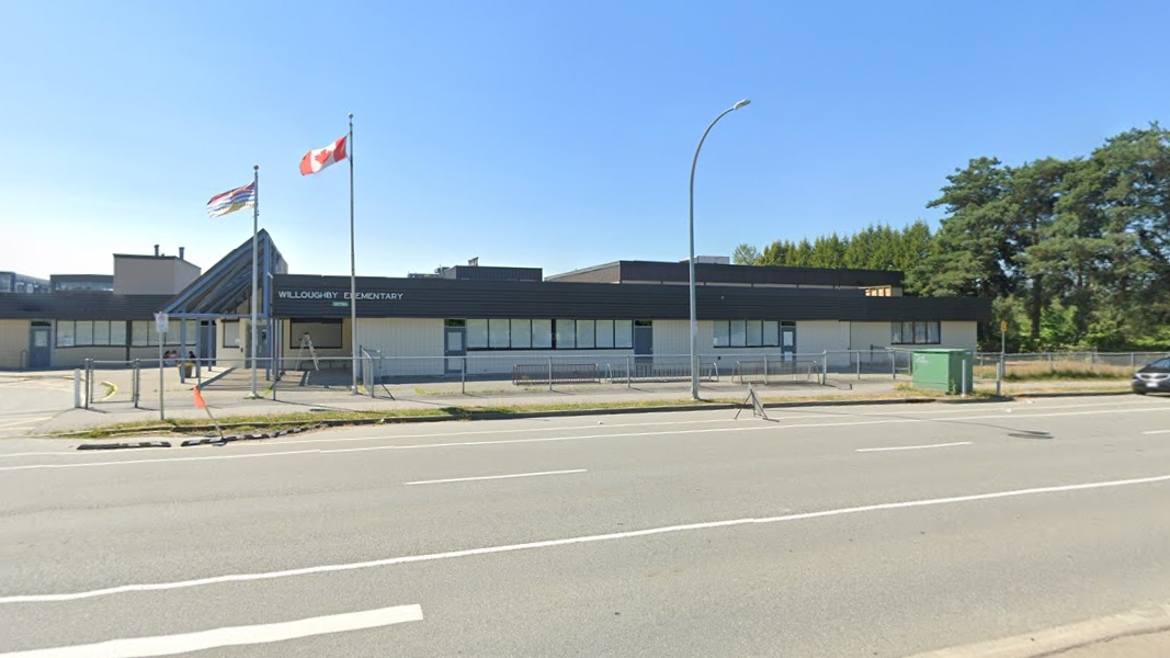
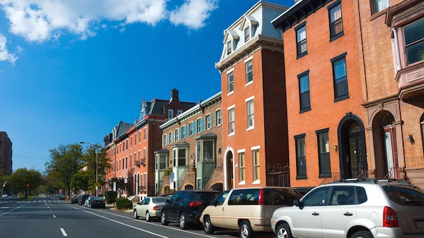
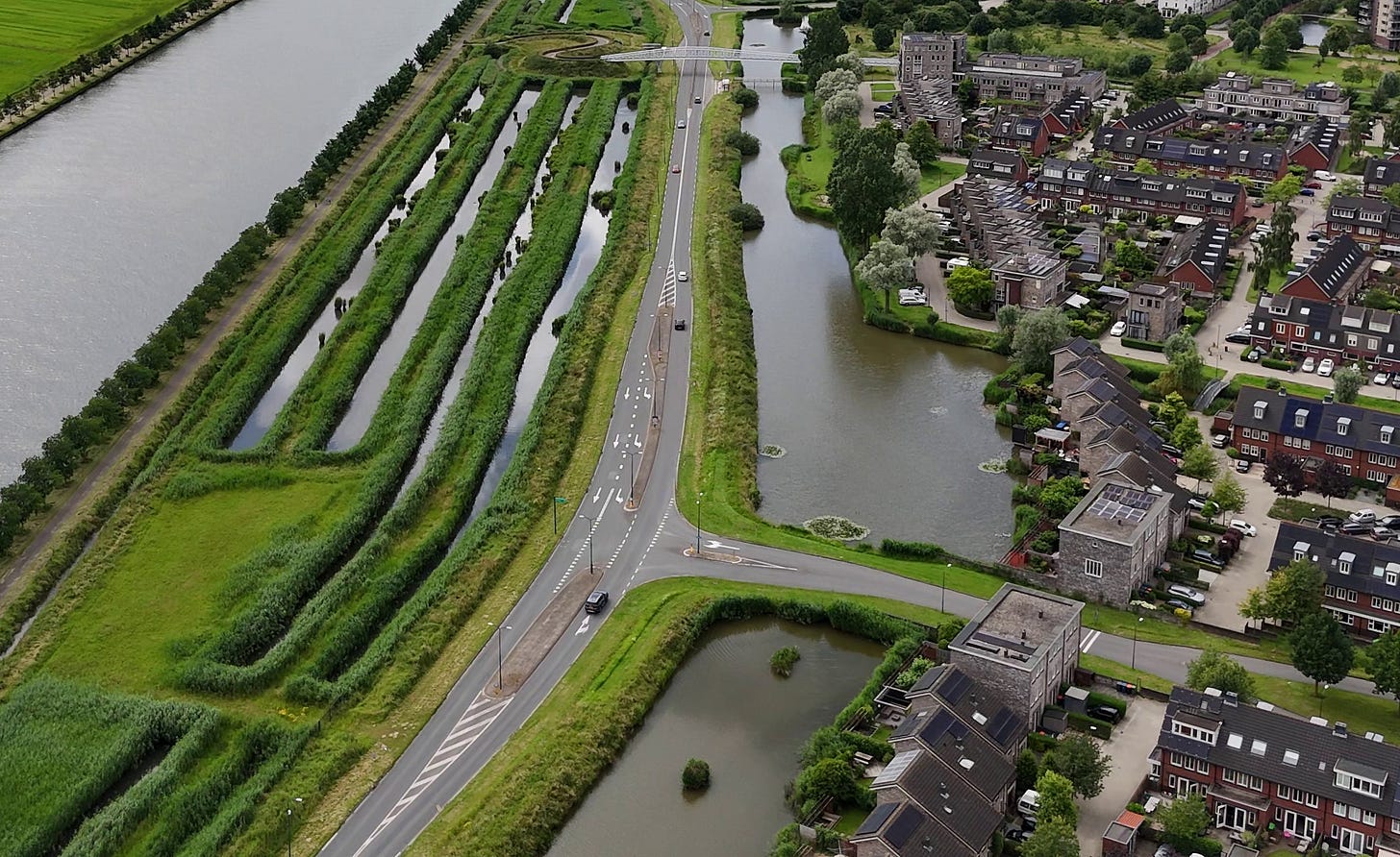
Willoughby Elementary School in Langley, BC. Source: Google Maps.
Editor's Note: Cities often discover, years after a neighborhood is built, that critical civic sites like schools, parks and libraries were placed next to the fastest and widest roads in the community. What follows is an attempt to fix that mismatch after the fact. The Township of Langley’s recent land swap to relocate a school site is a good example of how these decisions compound over time.
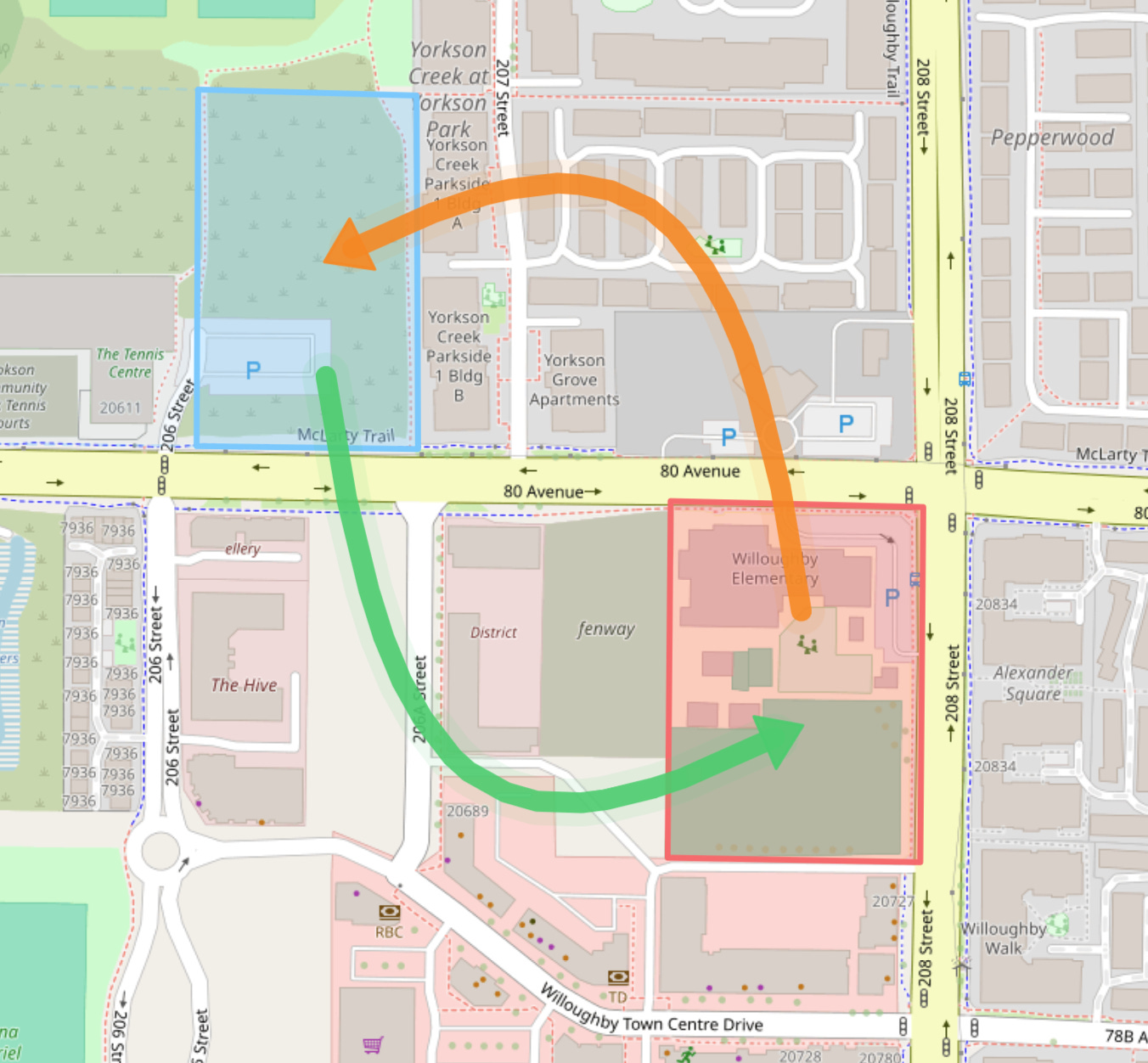
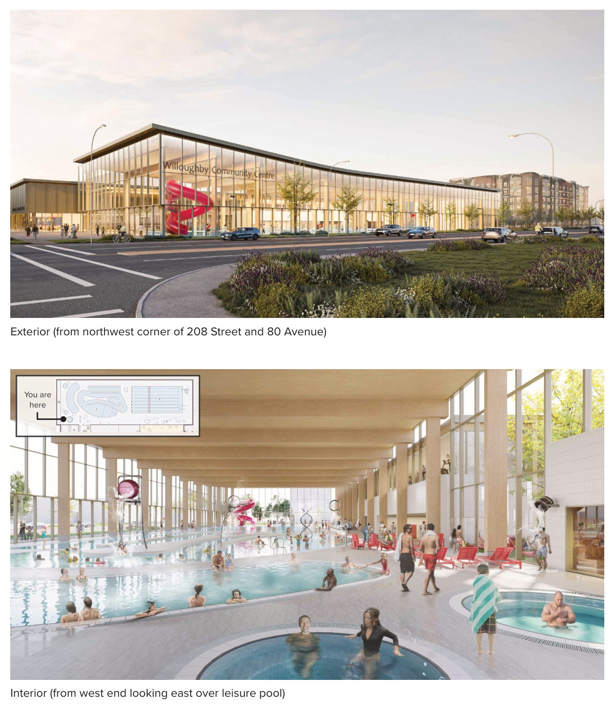
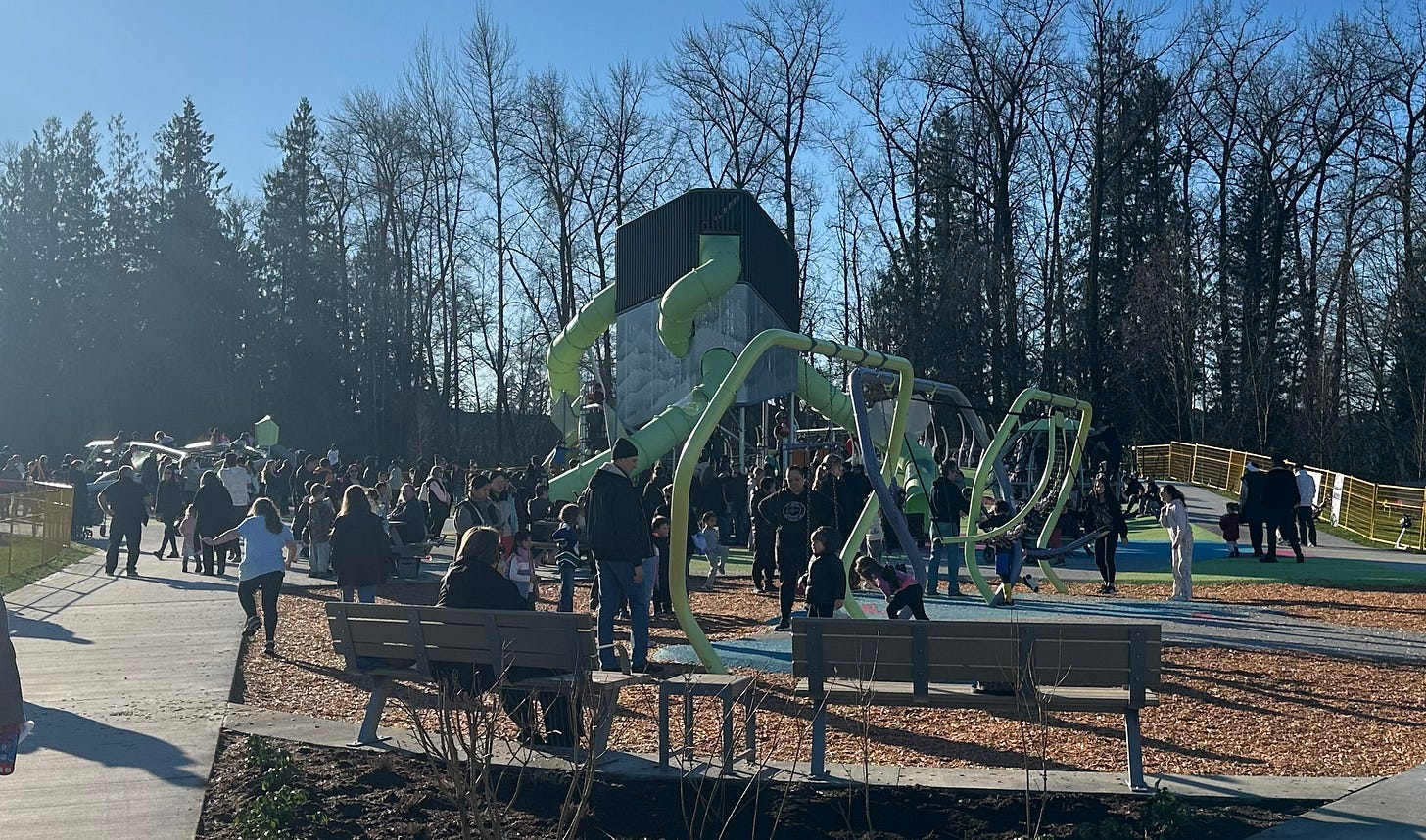
Last month, Langley, British Columbia, and the Langley School District announced an agreement where the township will pay to build a new school as part of a land swap deal. The deal gives the township the Willoughby Elementary School site at 208 Street and 80 Avenue (shown below), in exchange for the school district receiving a slice of land the township owns, located adjacent to the tennis center on 80 Avenue. This is being done to facilitate the construction of Willoughby Community Centre at 208 Street and 80 Avenue.
This land swap isn’t just a local real estate transaction, however. It’s an example of how cities sometimes have to unwind earlier planning assumptions when they collide with real life.
So What Is This Land Swap All About?
Planning began for a Willoughby community center back in 2023–2024, using the aforementioned vacant land near the tennis center, and was presented to the public at an open house in March 2024.
However, it’s clear concerns began to develop about using this site. In 2025, a second open house was held about the community center, which proposed building at 208 Street and 80 Avenue instead of Yorkson Park South. The larger site offered a number of benefits that addressed design and functionality limitations identified with the original location.
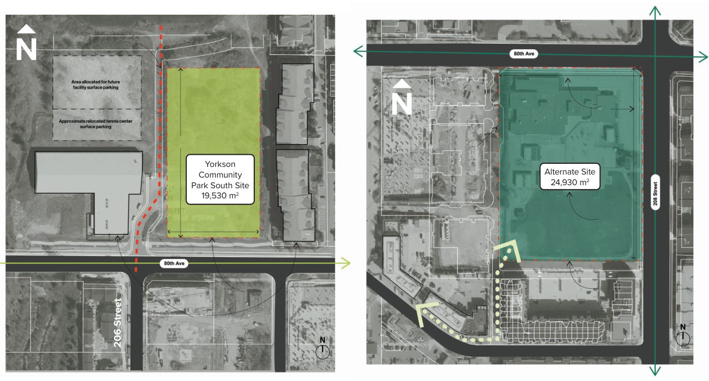
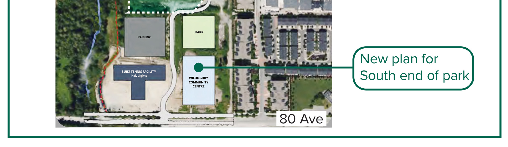
The Yorkson Park South site was certainly a simpler option: it’s vacant, readily available, and would have been faster and cheaper to build on. But its narrow 19,530-square-meter footprint was limiting. The 208 Street and 80 Avenue site, while requiring this complex land swap we’re now seeing, gives the Township 24,930 square meters to work with, much better integration with the surrounding urban area, improved building orientation, and the chance to create a real community hub.
Was It Worth the Delay and Extra Cost of Building a School?
The current administration has received a fair bit of flak for seemingly “rushing” to push a lot of things through quickly. In fact, the mayor has been quoted stating that “things never move fast enough for me” in relation to getting projects started and completed.
From a political perspective this approach is somewhat understandable: four-year election cycles combined with limited staff resources provide narrow windows for political leaders to show they are “getting stuff done.”
However, this often comes at the expense of better long-term planning. Many of the arterial roads in Willoughby, which we are now seeing constructed or completed, were surveyed and had engineering drawings filed many years ago, and these existing drawings, even though they are very wide and car-centric, were just picked up and implemented quickly under a debt-financed model due to political and time pressure. The only notable modification was adding concrete protection to the bike lanes, which (while this is a welcome improvement) were basically the maximum extent of the possible changes when using these existing plans.
What’s notable is that this planning decision for Willoughby Community Centre is actually a surprising break from that approach. It is a better evaluation of community needs: an aging school located on a busy intersection, care and attention being paid to the overall urban fabric, and also the desire to build a larger community centre that won’t be bursting at the seams on opening day.
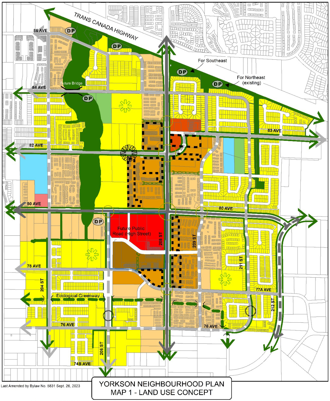
We’ve already seen what happens when something is underbuilt: schools in Yorkson that followed flawed student estimate formulas that need portables from day one. The brand new Yorkson Park Playground, while an excellent community asset, is overrun on the occasional sunny days we have at this time of year.
For the cost of building a school, the township gains an additional 5,400 square meters (58,125 square feet) of potential community center floor space — a larger site in a better location with no land acquisition costs. In this plan, parking will be built underneath the facility, which avoids the poor land use and less pedestrian-friendly environment of large amounts of surface parking, something particularly important in the urban centre of Willoughby.
If the township can also secure additional funding from the provincial and/or federal government, then it makes even more sense to try and get the best possible facility we can.
I also want to recognize that this reflects significant planning effort to squeeze in a facility large enough for the community right in the core of Willoughby, instead of building a “drive to” facility out of the urban center, which would incur more transportation investments and harm walkability and accessibility.
With all this in mind, I personally think it was worth it for the township to pay to build the new school. There is no cost estimate on this yet, but it cost the province $51.8 million to build Josette Dandurand Elementary in 2023, which gives some idea.
Others may disagree with this approach, and I won’t argue it’s another huge cost on top of accumulating debt, but it’s worth considering that buying more land to build a bigger community centre or a second facility sooner (at future higher construction costs) would have also been an additional expense.
Yorkson Was Planned Based on an Assumption That Never Came To Be
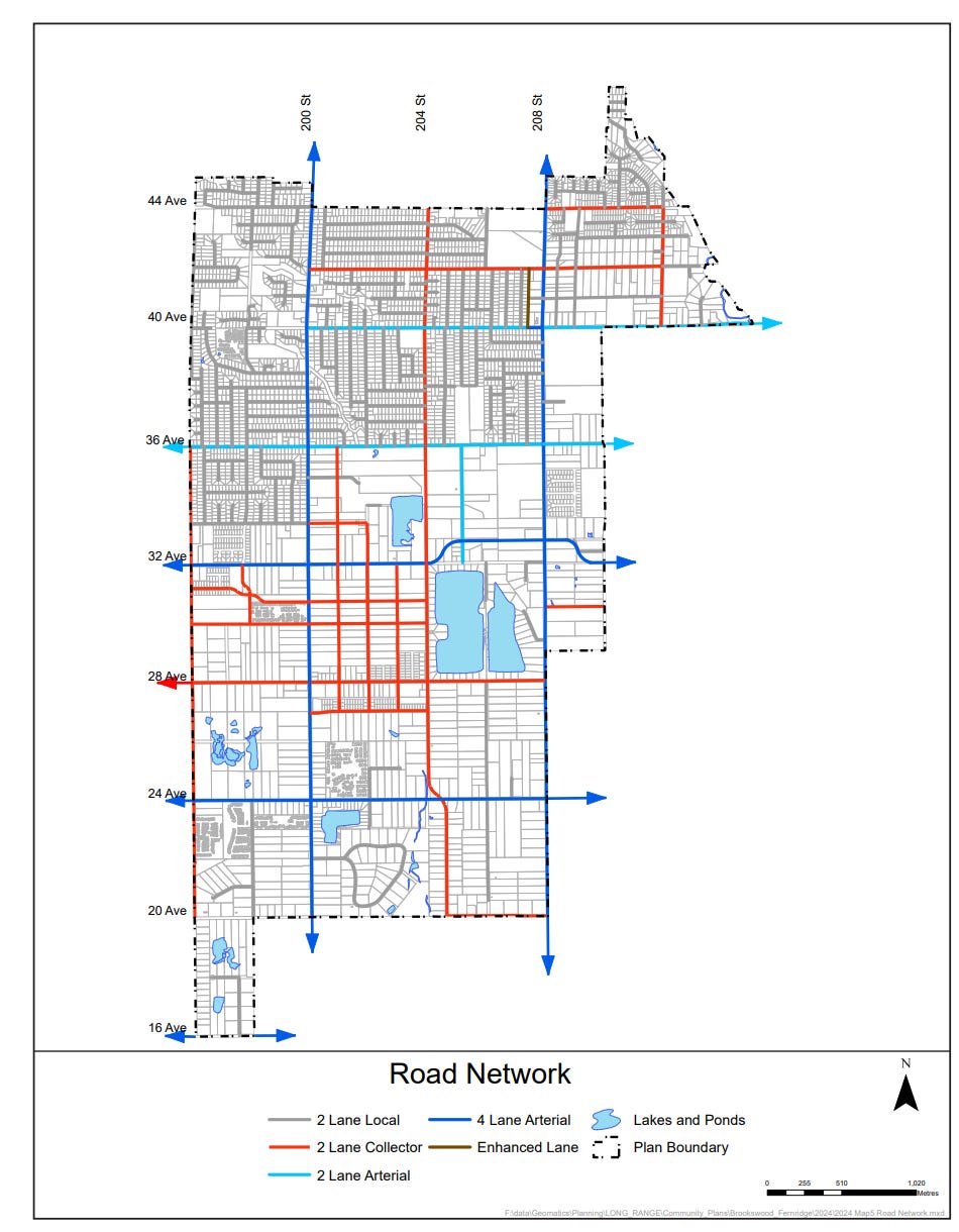
When planning the Yorkson neighbourhood in the early-to-late 2000s, planners felt confident that the Willoughby Elementary School, built in 1976, would be torn down and moved by the province. They went so far as to designate the school site as part of the Town Market/Town Centre area in the plan:
The Yorkson neighbourhood is expected to generate about 1,700 elementary students. This would require four elementary schools, including a replacement facility for Willoughby Elementary School. The Willoughby Elementary site is designated as Town Market and is anticipated to be redeveloped in the future for commercial or mixed use purposes.
- Yorkson Neighbourhood Plan, Section 5.3 Schools
This never happened. 208 Street and 80 Avenue were designated as wide arterial roads assuming that the school wouldn’t be there, or would be moved. The result we see today is young children exposed to poorer air quality and families who have to cross two busy, wide roads. This shows how the land swap deal is, at least partly, an externalized cost of that original assumption that never came to be.
Yet Another Symptom of Poor Arterial Road Placement
This outcome was also in part caused by planning neighborhoods to have a grid of hostile and busy arterial roads. In the original neighborhood plan, this might not have been foreseen as severe of an issue, as for the front of the school/town center area, the plan proposes 208 Street be scaled down to a street, with raised crosswalks and wide sidewalks.
However, there is resistance to allowing or adding raised crosswalks like this on arterial roads. It’s seen as a form of traffic calming, most of which is not permitted or generally considered on arterials due to the current transportation planning approach.
If Yorkson had been designed with a perimeter arterial ring road, with an internal grid of narrow streets, this might not have become such a major issue. Instead, the plan called for a grid of wide arterials.
These arterial roads are not only expensive to build and maintain, they come with huge externalities not often considered: parking lots for all the cars, a higher number of fatal accidents, traffic calming on adjacent roads to prevent rat-runners, and now schools that have to be moved because we don’t want to expose children to vehicle exhaust.
There are institutional forces that continually push for these expensive and unnecessary arterial road grids, and this needs to be addressed, and we will continue to advocate for a better pro-active planning approach.
Thankfully there is a small ray of hope in that a road design is being considered for 208 Street in Brookswood:
2. 208 Street in Brookswood
Be it resolved that Council direct staff to Report to Council with potential design options and high-level cost estimates for upgrading 208 Street from 44 Avenue to 36 Avenue to an urban arterial standard. The upgrade should consider sidewalks, treed medians, and bike lanes, in accordance with the urban arterial road standards being developed as part of the Transportation and Mobility Study currently being finalized for Council’s review. The report shall include an analysis of both a two-lane urban arterial road and a four-lane urban arterial road.
The community/neighborhood plans call for this to be a four-lane arterial specifically, whereas this motion calls for a two-lane design to be considered. This is notable because this section of road runs in front of Brookswood Secondary School.
I hope that this reflects a small push toward improving Brookswood’s plans to eventually pare down its planned arterial grid, an approach that Willoughby has shown creates a pedestrian-hostile environment and comes with huge implications and costs.
In the same agenda is the final report of the Township-wide Parking Study and Bylaw Review. The report is worth reading in full, but this paragraph caught my eye:
Continue to prohibit on-street parking for new arterial road construction. Travel demands are projected to rise substantially within the Township. The Township has a limited amount of road space, which needs to be used efficiently. Prohibiting on-street parking on newly constructed arterial roads ensures that these corridors function as intended to safely and efficiently support higher traffic volumes, transit, emergency access, and goods movement.
To me, this is another clear signal that we need to keep arterials away from homes and businesses as much as possible. Arterials cannot effectively be used for on-street parking within the current paradigm, and as such, don’t belong in front of homes and business where people may wish to park and business owners may wish to have convenient parking. We don’t want people to fly by businesses at 60–70 km/h on their way somewhere else; we want them to slow down, stop and actually visit those businesses.
This parking study finding reinforces that our current approach to arterial road placement creates problems that cascade into other areas of planning. First we build wide, fast arterials through neighbourhoods. Then we can’t allow on-street parking because they need to move traffic efficiently. Then businesses struggle because customers have nowhere convenient to stop. Homes on busy roads become less desirable. And schools become hazardous for children because of the traffic volume and speed.
The report’s proposal to have no parking on arterials, along with the institutional resistance towards raised crosswalks on arterials we mentioned earlier, makes sense when we imagine arterial roads where they should be: on the outskirts connecting places quickly, not trying to be both a neighbourhood street and a fast connector simultaneously
The Langley land swap is ultimately a small correction to a much larger pattern. For decades, we’ve designed suburban neighborhoods assuming wide arterial roads are necessary for growth. But those roads often create conflicts with the very places communities care about most: schools, parks, and neighborhood businesses.
Cities everywhere are now dealing with the consequences of those decisions. The question isn’t whether we’ll encounter these tradeoffs, but whether we’ll learn from them before repeating them in the next neighborhood.
[[divider]]
This article was originally published, in slightly different form, on the Strong Towns Langley Substack. It is shared here with permission.
James Hansen is the leader of the Local Conversation group Strong Towns Langley. He works to foster relationships with likeminded members of the community, along with councilors, mayors and staff to advance the mission of Strong Towns. Using his background in software development, he has developed advocacy tools and an analytical approach to policy, while taking a creative approach when producing content and promoting the group on social media. He hopes to see Langley evolve into a more connected and resilient community through collaborative efforts and innovative solutions.